
... distant places ...
Faroe Islands
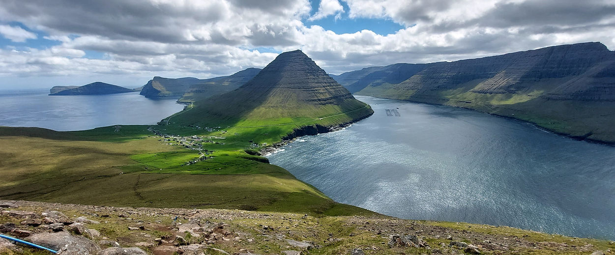
Faroe Islands
Tórshavn - Gásadalur - Sørvágur - Kallur Lighthouse - Suðuroy -
Cape Enniberg - Eiðiskollur - Slættaratindur - Gjógv
The Faroes are an archipelago of 18 islands, located halfway between Iceland and the west coast of Norway in the far Northern Atlantic. Lately, the place has achieved cinematic fame as James Bond’s final resting place with social media being full of images of its often otherworldly landscape. But don’t expect a welcoming climate. The Faroes is one of the gloomiest places on earth, and what passes as a summer day around here, might be considered a chilly autumn affair in other parts of northern Europe. But of course, that’s the reason why the islands remain a low-key tourist destination. Who wants to hike up a steep extinct volcano in late June, while a howling gale makes your teeth clatter? Carlos and I of course.

at the northern edge of Kalsoy Island
The World’s Gloomiest Capital. Tórshavn
With a population of 14,000 people (23,000 in the wider municipality), Tórshavn is the archipelago’s only city (well, a small town really), with the dubious claim of having the least annual sunshine hours of all capitals across the globe; 840 hours to be precise. Second placed Icelandic neighbour Reykjavik sports an almost Sahara-like figure of 1,300 hours. Tórshavn is the islands’ commercial hub, with by far the largest number of shops, eateries, museums, or art venues. This is where the government has its ministry, where most goods are loaded and unloaded and where international ferries leave for Iceland and Denmark.

Tórshavn. Capital of the Faroer
But don’t expect a metropolis. The islands only have 9 traffic lights, 8 of them located in the capital. This gives you an indication of just how compact the place is. But it is also undoubtedly charming and endearing. And who doesn’t like a place that offers largely unrestricted inner-city parking at practically every time of day.

Box 1: A brief history of the Faroes
DNA analysis of barley and peat points towards the existence of human settlements on these shores as early as the 4th century AD. An Irish monk by the name of Dicuil, who handily was also a geographer, crossed choppy Atlantic waters to establish a permanent settlement some 200 years later. But it was not until another 200 years had passed when Norse farmers (and their livestock) claimed these lands in the 8th century. No neolithic settlements here (too steep), no Romans either (too cold), and hardly any Vikings (no one to ransack and slaughter), which means that the islands lacks the historical layers of other North Atlantic communities such as for instance those on Orkney.
With the unification of the kingdoms of Norway and Denmark in 1380, the Faroes were subsequently ruled by the Danish sovereign. This lasted pretty much until 1940 when Nazi Germany invaded its northern neighbour. In return, the British military established a stronghold on the Faroes throughout the duration of the war, during which time a vocal independence movement started to emerge. A subsequent referendum, held in 1946 narrowly passed by 161 votes. Yet King Christian X of Denmark declared the plebiscite void, under the bizarre pretext that the number of invalid votes (481) was actually higher than the winning margin. But in return, the islanders gained a great deal of autonomy, and apart from currency, foreign affairs and defence, the Faroese pretty much run their own show without much interference from Copenhagen.
This was demonstrated during Denmark’s integration into the EU in 1973. Fearing for the autonomy of its fishing industry, the islanders declined to join and to this day are not part of any EU policy. (As a notable example, EU citizens do not have the automatic right to buy property). But the Faroes are a member of NATO. Looking at a map, this seems wise given the close proximity to the Russian naval base in Murmansk. The islands’ location is where NATO's frontier clashes with potential Russian expansionism, and the archipelago’s territorial waters are a hotbed for submarine activity with the Faroes (and Norway), being a crucial outpost on the Alliance’s northern flank.
In today’s turbulent geopolitics and amidst the United States’ desire to annex Greenland, a close alliance between Faroe and Denmark is regarded as a vital safe haven. No wonder, a small country of just 55,000 souls could easily be conquered. But across the political spectrum, there are almost unanimous calls for greater sovereignty with the aim of establishing a Commonwealth with the Faroes, Greenland and Denmark as equal partners.
Tórshavn. Old Town

Gásadalur
A Troika of Wonders: Gásadalur, Sørvágsvatn and the Kallur Lighthouse
If you can only spare a couple of days, these three sights undoubtedly represent the highlights of the Faroes, and feature heavily on social media travel sites. Gásadalur, located just to the north of the airport, is undeniably pretty with a veil-like waterfall cascading down into the ocean from the village’s edge. Up until the completion of a tunnel in 2006, the dozen or so houses were cut off from civilisation and were only accessible by boat, or via a steep, mountainous track. You can hike that path: on the road to the village, just before the entrance to the tunnel is a dirt track on the left that leads to a small parking lot. From there it is a vertical climb and descent with wonderful views of the village, the waterfall and the storm-battered coastline. Prepare for a strenuous exercise: The trail is a mere 10 km out and back but might take close to 4 hours to complete.
And while you are in the neighbourhood, you might as well visit the ‘lake above the ocean’ at Sørvágsvatn. The entrance to the trail is near the village of Midvágur which is located just to the east of the airport. Follow the road signs (or the coaches and taxis that deliver numerous visitors to the level and flat trailhead). Encountering this surreal natural setting however will set you back a thumping 200 DKR, which judging from the throng of walkers must surely represent a nice little earner. Two hours out and back should do the trick.

Sørvágsvatn
The third highlight, however, requires a little more planning, as you have to book public transportation. Make your way to the town of Klaksvik on the island of Bordoy, which is handily accessible via one of those four sea tunnel. From there, you need to embark on a 25-minute ferry (route #56) to the sparsely populated and incredibly vertical island of Kalsoy. Bus #506 awaits passengers on the other side in Syðradalur to drive all along the spine of the island to the tiny hamlet of Trøllanes (population 18). A park ranger awaits to collect yet another 200 DKR before a gentle climb leads visitors to the stupendously positioned and otherworldly lighthouse at Kallur, with views towards the two sea stacks at Eiðiskollur in one direction, and towards Europe’s steepest cliff at Cape Enniberg in the other; a fitting location for Daniel Craig’s James Bond to meet his maker in ‘No Time to Die’. Out and back, the trail is just under 5 km.

The Kallur lighthouse on the island of Kalsoy
On the return to the ferry, the bus stops at the slightly bigger village of Mikladalur (it even has a church!); a cute collection of holiday homes and the odd farmhouse that are tumbling down to the shore where the statue of the seal woman offers an intriguing sight. Legend has it that a female seal shed her skin which was witnessed by a local lad who of course fell in love with the mammal. He hid her skin, thus forcing her to live on land, yet after years of enforced human domesticity, she retrieved the skin and escaped back to her ocean-based lover. Not surprisingly, the local lad was enraged, killed the lover, as well as the children that he had raised with the seal woman. A rather dramatic tale in line with the setting of the statue on a beautiful spot next to a waterfall with the neighbouring island of Kunoy lurking in the background.

Mikladalur
Puffed up: The Birds’ Paradise of Mykines
Heralded as one of the jewels in the Faroese tourist crown. Just a 30-minute ferry hop (route #36) from Sørvágur lies this compact speck of rock that is home to 18 humans and thousands upon thousands of birds, chiefly among them impossibly cute puffins. Apparently, the cliffs are mightily steep and mesmerising, the meadows a verdant green with a couple of farms nestling picture-perfectly against the side of a steep hill. We saw none of that and experienced a total fog wipe-out.

Mykines in the sun

Mykines on the day of our visit
I blame the ferry connection. A boat accommodating a maximum of 50 people makes the journey three times a day, and tickets get booked up days, sometimes weeks in advance. And if the weather is stormy or the sea too rough for the tiny vessel to navigate a safe passage into the islet’s narrow harbour, then the ferry doesn’t set sail at all (yet in the process refunds customers promptly). So we had to take our chances. At the first try, our journey was cancelled due to adverse weather conditions. And the next availability was on one of the last days of our trip. We reserved the final two tickets and crossed our fingers. To no avail. But at least we experienced a nicely rolling sea with some of our fellow visitors staring sternly into the distance in a desperate attempt to hold on to their breakfasts. And of course we encountered those puffins, which strangely really do not mind if you walk up close. It could have been the miserable weather affecting my mood, but I found the Faroese variety being of a rather scrawny appearance in comparison to their much pluckier looking cousins on Orkney. Maybe it’s the seafood in this part of the Atlantic. Pretty much the entire ferry passenger load then descended onto the village’s sole café (whose proprietors were unsurprisingly thrilled by the gloomy outdoor misery). Never mind. You need some low points along a journey to fully appreciate the highs.
Box 2: The Faroese Economy
At first glance, life in the far north seems prosperous: The Faroese GDP is comparable to that of affluent Denmark. Unemployment frequently dips below 1%, and excellent health care provisions are reflected in an average life expectancy of over 83 years. But there is one structural impediment: the over-reliance on fish. Over 90% of the country’s exports relate to maritime biology, whether as seafood (and here in particular salmon, cod, or mackerel), or as Omega 3 supplements for the pharma industry. You can spot the circular nets of the numerous fish farms in practically every bay or fjord.
And the next impediment comes in the close proximity to one of its North Atlantic neighbours: Russia. Granted, the European Union still takes the lion’s share of Faroese trade (three quarters of imports and half of exports). But the islands also have strong commercial ties with the Putin regime, and the national government did not sign up to EU sanctions in the aftermath of the Crimea and Ukraine invasions. Nowadays, a whopping quarter of its exports are destined for Russia. Talk about dancing with the devil. Maybe the prospect of oil exploration (with deposits found just recently) might calm geopolitical (though not environmental) nerves.

Slættaratindur
The only way is up: Slættaratindur, Eiðiskollur, Rustatindur, Cape Enniberg
This section is devoted to those readers, who would like to give their leg muscles a thorough workout. None of these hikes require technical skills, all can be done in less that 4 hours, but the ascents are viciously steep. As mentioned so many times now, the weather could just be your worst adversary, so you only have yourself to blame if you return to the car park cold and wet. Keep in mind though that during the summer, it never really gets fully dark, and it’s perfectly feasible to be out and about at ten at night. So if the clouds grant you a window of opportunity, head for the hills.
The Faroes tallest mountain Slættaratindur is located on the central island of Eysturoy and the trailhead can be accessed via the scenic mountain road #68 that links Eiði and Funingur. Straight from the car park the trail rises steeply in a lung busting fashion, but after about 45 minutes, the path starts to level out (just a little bit). The usage of drones are not allowed across all of the islands, yet we heard a soft hum in the distance, which disappeared as we neared the summit. At the top, a fellow hiker greeted us and together we enjoyed much deserved and fabulous 360 degree views. Now, was that a Russian accent I spotted?
2 hours, 5 km, highest point at 838 m, 458 m elevation gain.

Box 3: Hiking in the Faroes
Come prepared. The weather on the islands can be atrocious at any time of year and can change in a flash. Single digit Celsius temperatures in the summer months are not uncommon, as are hailstorms and potentially violent gales. If you are out and about and want to avoid hypothermia protect yourself against any meteorological eventuality.
But the climate is also part of the attraction. The islands would be suffocating under mass tourism if they were located somewhere more sheltered. So, if you are standing on the edge of a mighty cliff, dripping wet and engulfed in a blanket of cloud and mist, feel privileged as not too many tourists are sharing such a wild natural exposure. And thankfully, Mark Twain’s assessment of the weather in New England also holds true for this corner of the North Atlantic: wait 5 minutes and the clouds might just lift.
You also have your credit card or payment app ready, as the government has imposed a steep 200 DKR fee for hiking the most popular trails, including Sørvágsvatn (the one with the lake above the ocean), Mykenes island (the one with the puffin colony), or the lighthouse on Kallur island. Even hiking Cape Enniberg on the remote eastern island of Vidoy will set you back the same amount, although on this occasion, the trail passes through privately owned land.
Now there’s only one more obstacle to overcome: The Faroe Islands are of a volcanic nature, and thus incredibly steep, with practically every trail described in this post giving your calves a crunching workout. If you desire gentle paths and gradual inclines you have come to the wrong place.
Eiðiskollur
Eysturoy is also the location for the Eiðiskollur cliff. Make your way to the village of Eiði, whose main road winds its way up to the trail head. Once at the top of the cliff, hikers will come across a British military installation dating back to World War II. More noteworthy though are the uninterrupted views across the North Atlantic (apparently all the way to Iceland some 270 miles away). Below are two sea stacks referred to as Risin (giant) and Kellingin (witch). Legend has it that Iceland was so jealous of the beauty of the Faroes that they sent these two creatures to drag the islands up north. Alas, the witch and the giant dithered for too long, and morning sun light turned them into stone. That legend sounds a little improbable given the parsimony of sunlight in this corner of the Faroes. Maybe they were just caught out by bad weather and subsequently lost all will to live. That’s my theory and I’m sticking with it.
2 hours, 7 km, highest point and elevation gain: 354 m

Rustatindur
And another hike on Eysturoy, this time on the eastern fringe of the island, to the hill range at Rustantindur. The starting point is in the pretty (buzzing even by Faroese standards), village of Fuglafjørður. Look for the local football pitch. Just behind it is a marked trail up to Rustatindur mountain. Kalsoy island (the one with the famous lighthouse) gradually comes into view, as is a giant fish farm off the village of Hellurnar just below you. Before you leave the area, make sure to visit Fuglafjørður’s culture house for a little local history and arts & craft.
2 ½ hours, 5.5 km, 484 m highest point and elevation gain

Villingadalsfjall Mountain at Cape Enniberg
My personal favourite by far is the monumental ascent to Cape Enniberg on the island of Vidoy in the far northeastern corner of the archipelago. We drove along route #70 through a succession of impressive tunnels all the way to the isolated community of Viðareiði, another picture-perfect hamlet with timber houses old and new, and a dainty wooden church surrounded once more by a fabulous natural setting dominated by Villingadasfjall, the Faroes third highest mountain. For once we encountered what must pass as a splendid summer day on these shores. Partial blue sky, hardly any wind and a balmy 14 Celsius (56 Fahrenheit). Everyone was out and about, washing the car, mowing the lawn, dressed in T-Shirts and shorts of course. The start of the hike is just above the village where hikers first pass a toll gate (with a sign informing you how to transfer the 200 DKR electronically, in case you did not bring enough cash to place in the padlocked honesty box). The path then leads up a steep mountain side until you reach a barren plateau of boulders and rocks. This is epic stuff, not just because of the stupendous views but also because of the gradient of the hike. On the way down, a cheerful hiker bathed in sweat inquired when the trail would start to level out. We knew exactly how she felt and couldn’t find it in our hearts to tell her that she barely covered a third.’ Nearly there’ was our much more encouraging response.
8 km, 4 hours, 825 m elevation gain, highest point at 786 m.

Cape Enniberg
Southern Comfort: The island of Suðuroy
Another ferry (route #7). This time a two-hour ride on a big, vehicle-carrying Smyril vessel with an agreeable café and restaurant departing from the capital Tórshavn. The southernmost island in the archipelago represents the Faroes at its prettiest. It’s all there in abundance. Driving around the island we came across idyllic villages (most notably Vágur) and stopped frequently to take in majestic coastal settings. The cliffs at Vagseiði resemble an amphitheatre of raw natural beauty. The same rings true for Asmundarstakkur at the island’s north-western edge near the village of Sandvik. At Suðuroy’s opposite end, the cliffs at Akraberg even sport a lighthouse to raise the photogenic stakes.

Vagseiði
Box 4: Multi-culturalism:
Visitors to the Faroe Islands cannot fail but notice the significant number of people of Asian or mixed-race backgrounds. People might assume that this is yet another laudable testimony to a progressive Scandinavian society that has integrated non-Europeans, whose lives might not be as fortunate as their own. While this might be true, there is also a far more practical explanation. For many years, the archipelago had a persistent female gender gap, and for around 2,000 or so men folk, finding a partner has always been just that little bit more challenging. After studying in Denmark many Faroese women often remained on the mainland, which seems quite understandable given the prominence of the male-dominated fishing industry. By the 1990s though, those males who were unsuccessful in their mating pursuits ventured for bride-seeking trips to the Philippines or to Thailand. Their offsprings nowadays represent the third immigrant generation of Faroese citizens. Exact numbers are impossible to come by, as the national census does not record entries based on race or ethnicity. But walking around the towns and villages, the level of cultural diversity comes as a pleasant surprise.
Hikers too are well-catered for. We walked the 8 km (out and back) to the ice-age lake at Hvannhagi traversing a high plateau of rare grassland with stunning views towards neighbouring Sandroy island. (The trail head is just behind the hospital in Tvøroyri). And there’s history to admire. The church in the hamlet of Fámjin proudly displays the first Faroese flag, designed by a local resident named Jens Olivur Lisberg in 1919. Ignored by the Danish authorities for decades, it was the occupying British Army which first recognised the banner in 1940.

Akraberg
But apart from the phenomenal natural beauty, what really struck us was a landscape that was noticeably gentler. Admittedly, Suðuroy’s west coast is just as steep and rugged as many other shores on the neighbouring islands, but the eastern slopes are less steep and grassier in marked contrast to the often rough and craggy appearance further north. Over the years, our senses got used to the ‘green and pleasant land’ that we now call home. Suðuroy gave a soft glimpse of this. Scots and Irish folk might know what I am referring to.
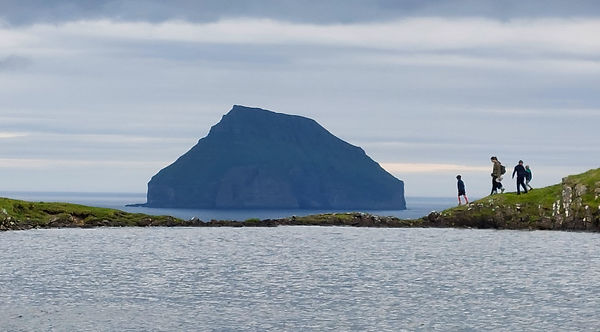
Hvannhagi
Insta Charme: the villages of Gjógv and Tjørnuvík
Though miles from anywhere these cute villages attract the cruise ship crowds, whose vessels have docked a good hour away in Tórshavn. More trainers and handbags than boots and backpacks. But the beauty is undeniable. Traditional wooden farmhouses, rolling farmland, steep and majestic cliffs. The full Faroese shebang. If you are heading for Gjógv on the island of Eysturoy, make sure to take scenic route #68 which connects the village of Eiði on the western side of the island with Funningur on the eastern edge. In between, the road rises up to the base of Faroe’s highest mountain Slættaratindur. The scenery is impressive.

Gjógv
And if Tjørnuvík on neighbouring Streymoy is your destination, the only road to take you there (#594) passes the Fossá waterfall, the tallest in the Faroes. You might want to take that drive after previous heavy rainfall to get the full natural spectacle.

Box 5: The Faroese Language
Don’t make the mistake of greeting the islanders with an enthusiastic and melodic ‘Hej’, just because you paid close attention to some Danish Noir TV show. We fell into that embarrassing trap. In fact, Faroese, in sound and word is much closer to Norwegian, and derives from old Norse spoken in the Middle Ages. And the grammar is unmistakably German, as afficionados of the genitive will reassuringly notice. With the unification of the kingdoms of Denmark and Norway in 1380, Faroese was suppressed for many centuries, and in schools, offices and courts, Danish was the only language spoken. But Faroese survived, though not in written documents but through songs and poetry that were passed down the generations. In 1937, Denmark finally accepted Faroese as the official school language. The laissez faire attitude of the British military which occupied the archipelago during World War II helped to encourage locals to speak in their vernacular, leading to official recognition (as well as a first Bible translation) in 1948. Today, Faroese children learn Danish as their first foreign language at the age of 8.
Tjørnuvík
Hanging with the Locals: Sauna and public swimming pools.
To chat to locals in Spain, you just need to be out in the street. In France joining an ongoing demonstration might help. In Britain you need to head for the pub, and in Germany you would be well-advised to mix up your recycling in order to illicit a response (albeit not of the kind variety). In the Faroes, frequent one of the numerous public saunas and swimming pools, especially after a long hike or when seeking shelter from a storm. We did precisely that on a number of occasions. And fear not. It is custom to keep your swimwear on.
Our chosen sweat fest was in Klaksvik, the islands’ second biggest town. The extensive municipal facilities included a 25 m pool, a kids section, several sauna types and outdoor ice baths, located right next to the football stadium which is the home of Klaksvíkar Ítróttarfelag (or Klaksvik Sports Club), frowned upon by many out of towners for their Chelsea-like approach of buying up all the talent that is available in the archipelago. How do we know all this? Well, you sit and sweat, speak a foreign tongue and pretty soon someone will talk to you in a very friendly manner to inquire where you are from and what you’re doing here. We had one fabulous encounter with a dude from a nearby island (he hated Klaksvíkar Ítróttarfelag) who went straight to the point. ‘We’re men. We talk football’, he pronounced, before a lively conservation ensued. He didn’t support the Gunners though ….

the football pitch at Eiði
Box 6: Football
Every little village in the Faroes is equipped with a well-manicured football pitch, often set against a backdrop of an insanely picturesque natural setting (my favourite one being the pitch in Vágur on Suðuroy). On any given day, somewhere across the archipelago a match or training session seems to be taking place, interrupted only by the fiercest of storms. And should the latest Atlantic gale renders accurate passing an impossibility, it is time to retreat to one of the plentiful indoor facilities. It certainly keeps the younger ones off their phone screens.
The inspiration to this impressive footie focus might just be the national football team, which in their first international match in 1990 recorded a stunning win against Austria (with a population that is bigger by a factor of 120). The match was held in Landskrona in Sweden due to a lack of a suitable domestic pitch. The team was subsequently managed by 1977 European footballer of the year and Danish icon Allen Simonsen under whose guidance the game was developed at grassroot level (hence the presence of all those football pitches). A national stadium was also quickly built which provides comfortable seating for 10% of the Faroese population (at just over 6,000). The most notable achievement was arguably under Simonsen’s successor Henrik Larsen (of Barcelona and Celtic Glasgow fame) when in 2002, mighty Germany only managed a narrow 2:1 win with the World Cup finalist sparred further blushes by a last minute Faroese shot that only hit the post.
Trip Essentials
How to get there and around:
Judging from the number of cars with foreign license plates, not just from Denmark, but also from France, the Netherlands, or Germany, quite a few visitors arrive on the 31 hour ferry ride offered by the state-owned Smyril Line, from Hirthals in Jutland to Tórshavn. Most people though take one of the flights offered by the national airline Atlantic Airways, which has an extensive number of direct links to London, Copenhagen, Oslo, Reykjavik, Paris, Barcelona, and New York City. Sun-deprived locals also take advantage of the direct connections to Gran Canaria or Palma de Mallorca. The Faroes international airport is located on Vágar Island.

Fishfarm at Hellurnar
The 18 islands of the archipelago are connected by an intricate web of tunnels; 20 of them being drilled through mountains, but also 4 tunnels that go underneath the sea, including the mad Eysturoy tunnel, which links the capital Tórshavn with the island of Eysturoy. It is the world’s only tunnel with a roundabout. When driving through, you will pass along a bizarre jellyfish-like art installation, as well as an illuminated 80 m long steel sculpture. Tune in to 97 FM radio for a complementary and flamboyant soundscape. You will be charged around 100 DKR every time you are using any of the sea tunnels, so make sure to plan your itineraries carefully in order to avoid clocking up hefty fees. The charge will be collected automatically via license plate recognition, and for car rental users, will be added automatically to your rental fee. The whole tunnel network is an impressive engineering feat. No wonder that the people of Shetland are envious and have been lobbying their governments in Edinburgh and London to build a similar set up.

Fuglafjodur
Any gaps in the tunnel network are filled by 7 inter-island ferries. There are also a staggering 29 different bus lines. Some ferries do get booked up, in particular those to the puffin paradise on Mykenes island or to Kalsoy island with the picturesque Kallur lighthouse. To secure your seat, simply log on to the website of the public transport provider Strandfaraskip.

Eiði
It is just about possible to tour the islands without any personal means of transport. The ferry and bus network will get you to all the places mentioned in this post. Yet, most visitors prefer the freedom of a rental car, the main reason being the flexibility your own set of wheels affords once the weather acts up; which unfortunately happens frequently.

Klaksvik
Where to stay:
The majority of sights are located on the central islands of Vágar, Eysturoy and Streymoy. The airport at Vágar is only a ten minute drive away from the beautiful and much posted waterfall below the village of Gásadalur. Another ten minute drive in the opposite direction lies the trailhead for Sorvagsvatn (the lake above the ocean). Thus, if you encounter fine weather on the day of your inbound flight, make sure to head for these places straight away. And Vágar island is also the departure point for the third of the top highlights, with the village of Sørvágur (also very close to the airport) as the ferry departure point to the Puffin island of Mykines.

Statue of the Seal Woman, Mikladalur, Kalsoy Island
Box 7: State-run liquor stores
Or to use the official acronym of ABC: alcohol-beverage-control. Buying booze in the Faroes requires some planning. Across the archipelago, there are only 6 outlets that sell alcohol with rather restrictive opening hours (usually from mid-day until late afternoon). The model works by having the government as the sole wholesaler and retailer of alcohol, with standardised pricing (no ‘buy one get one free’ here), and sensible units bordering on frugality (only 330 ml bottles of beer for instance), all designed to promote public health. Sounds familiar? You must be Canadian, since this model is found in all provinces bar Alberta. Other Scandinavian countries (but not Denmark) have also adopted this approach, with Finland deserving a special mention for naming its chain of liquor stores ‘Alko’. And 17 U.S. states complete the list, including Pennsylvania, Virginia and Utah. So please spare a sympathetic thought for North Americans and Nordic types when you encounter their enthusiastic disposition whilst duty free shopping at the airport. For those folks, buying alcohol is usually a chore. I guess that’s the whole point of the system.
Eysturoy is home to the islands’ tallest mountain Slættaratindur, and the pretty villages of Fuglafjørður and Gjógv. And the capital Tórshavn is located on Streymoy. This small town has by far the largest collection of hotels and Air BnB rentals. Tórshavn also offers a little more non-natural entertainment with its cafes, restaurants, galleries and museums which should keep you occupied in case the weather turns sour (but do not expect a metropolitan vibe. Tórshavn is a very compact affair).

Trollanes, Island of Kalsoy
Some visitors though might prefer the rawer sensation of being somewhere more isolated, though eateries and supermarkets will be harder to come by. We settled on a compromise by renting an Air BnB in Eiði – about an hour’s drive from Tórshavn near the northernmost tip on Eysturoy. The village had a supermarket, a bank and a tiny cafe (though the nearest restaurant was a 10-minute drive away) with easy access to most of the hikes and sights that we intended to visit. It served us well.


